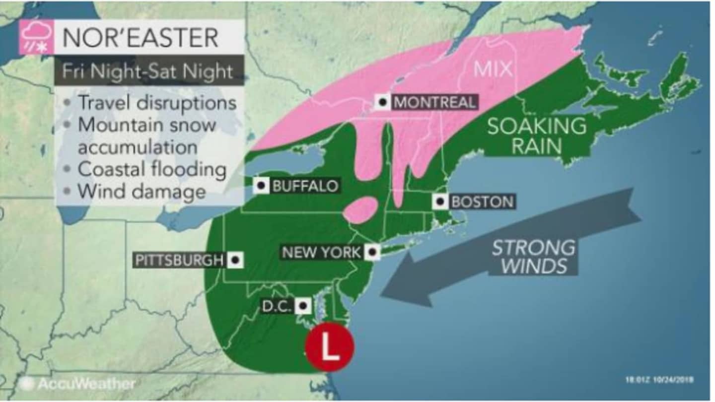
On Friday, Mid-Atlantic states will see Gale-force winds at the coast of between 40-45 mph that could cause power outages and widespread heavy rain with flooding possible.
The storm will rapidly make its way up the coast before arriving in the tristate area around midnight.
Rain will be heavy at times on Saturday, accompanied by strong winds of 15-25 mph with gusts up to 40 mph, along with a storm surge capable of causing coastal flooding with the high tide cycle late Saturday morning into early Saturday afternoon.
Major airport delays are expected on Saturday in the tristate area and New England.
Saturday's high temperature will be around 50 degrees, and it will hold steady throughout the overnight into Sunday.
With temperatures staying well above freezing throughout the area, the region with the highest chance for snow during the storm is now Northern New England.
"At this time, it looks like this storm will bring a general 1-2 inches of rain and a period of 40- to 60-mph wind gusts to the coast, and there will be some sort of wet snow over the interior," according to AccuWeather Senior Meteorologist Dave Dombek.
Most of the heavy rain will taper off Saturday evening with light rain and drizzle likely.
Sunday will be mostly cloudy with a high in the low-50s.
Check back to Daily Voice for updates.
Click here to follow Daily Voice Paramus and receive free news updates.